An Overview
The Andaman and Nicobar Islands are a submerged mountain range. They are geologically part of the Arakan Yoma (also called the Rakhine Mountains) mountain range of Myanmar, which extends southward into the Bay of Bengal and re-emerges as the Andaman and Nicobar archipelago. In other words, the islands are the visible peaks of a mostly submerged continuation of this range. This mountain range was created due to a historical geological development that took place more than 100 million years ago. They are sea mountains that rose out of the ocean floor when the Indian plate collided with the Burma minor plate.
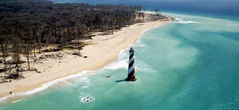
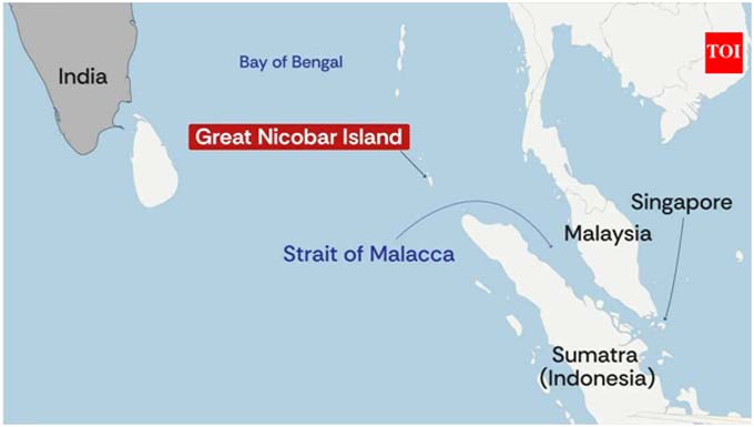
The Andaman and Nicobar Islands stretch roughly 800 km north to south, making them India’s longest island chain. They comprise of 836 islands, of which only 31 are inhabited. The islands occupy a total land area of 8,249 km2. The capital city is Sri Vijaya Puram, formerly Port Blair. The Andaman and the Nicobar group of Islands are separated by the 150 km wide Ten Degree Channel. The northernmost point of the Andamans, the Landfall Island, is 901 km from the mouth of the Hooghly River. The southernmost point, on Great Nicobar Island, called Indira Point, is also the southernmost point of India. From Indira Point, to the northern entrance of the Strait of Malacca, the straight-line (crow flight) distance is about 145 km. The Six-degree channel which lies between Indira Point and Rondo Island of Indonesia’s Aceh Province, has a width of 163 Km (88 nautical miles). It is a deep and clear channel, suitable for navigation by large merchant vessels. Three major sea routes of the Indian Ocean originating from or destined to the Cape of Good Hope, the Gulf of Aden and the Straits of Hormuz converge here. As a result, the shipping density remains high which enhances its potential vulnerability for disruption.
Sri Vijaya Puram is located approximately 1,190 km from Chennai and 1,255 km from Kolkata. The northernmost point of the Andaman Islands (near Landfall Island) is about 220 km away from Myanmar’s southern coast across the Andaman Sea. Thailand is 650 km to the south-east.
To the average Indian, the Andaman is a far-off island called “kala pani,” where freedom fighters were imprisoned in the infamous Cellular jail by the British. Nicobar is even lesser visible known territory.
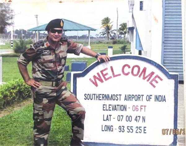 The author undertook reconnaissance missions to the Andamans over two years. He set foot on a number of islands from North Andamans to the Great Nicobar Island, and interacted with numerous islanders to gather information and ground realities. His submissions were widely appreciated.
A deeper study of the Andamans (a commonly used name that includes the complete Andaman and Nicobar group of islands), takes us into a lesser-known world. Here we find the original inhabitants, who are fully developed humans, but those who have no understanding of the modern way of life. They live frozen in time, in their own secluded tribal cultures, with none, or minimal contact with the world we inhabit. The Andamans are perhaps one of the few places in the world, other than the Amazon Rain Forest and Papua New Guinea, where such humans live.
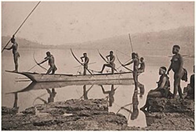
Genetic and cultural studies suggest that the indigenous Andamanese people may have been isolated from other populations during the Middle Palaeolithic era, more than 30,000 years ago. The indigenous small hunter-gatherer communities living mainly on the Andaman Island comprise of the Great Andamanese, the Onge, and the Jarawa, who have been isolated for thousands of years, and speak separate native languages. The North Sentinel Island, is home to the Sentinelese people, who are the only known uncontacted tribe in India. The Nicobar Islands, are populated by the Nicobarese and Shompen tribes. The Jarawas, and the Sentinelese are categorised as having Negrito stock. The Shompen or Shamhap, and the Nicobarese are of Mongoloid stock. The Nicobarese, is a collective name for all non-Shamhap tribes living on various islands such as Car Nicobar, Bhompuka, Teressa, and Nancowry.
In the early 21st century, the population of these indigenous people drastically dropped. As per the latest estimates only 51 Great Andamanese, 400-650 Jarawas, 101 Onges, 50-150 Sentinelese and 229 Shompens, are still surviving. The Government of India is employing various methods to protect the remnant tribal population.
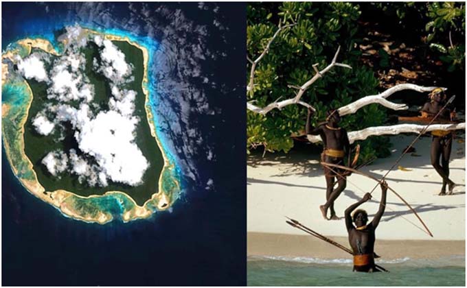
There has been recorded evidence of contact with the Sentinelese since the early 18th Century, but it is quite clear that the Sentinelese prefer to be left alone. Overtime many intruders have been killed. On 2 August 1981 a Panama registered freighter, MV Primrose, struck the coral reef just off North Sentinel Island, during a monsoon storm. The crew had to be winched up into helicopters, and barely survived the wrath of the Sentinelese. Thereafter, the Government of India declared the entire North Sentinel Island along with 5 km coastal sea from high water mark as a tribal reserve. The Sentinelese are in complete isolation practicing primordial hunting and gathering way of life. The Government, has adopted an ‘eyes-on and hands-off’ practice to protect and safeguard the Sentinelese tribe.
History
Early History. In the 11th century the Nicobar Islands were part of an established Chola trade route connecting India and South East Asia. Chola inscriptions from Thanjavur, dated to 1050 AD, describe the islands as Ma-Nakkavaram meaning “great open/naked land” in Tamil. The inscriptions also provide the first hard evidence of the existence of the Shompens. In the 17th Century, the Maratha Sea warrior, Kahnoji Angre is said to have briefly operated out of these islands.
European Colonisation. The Andaman and Nicobar Islands are natural jewels whose strategic location in the Bay of Bengal made them invaluable assets to many different colonial powers over the centuries. The first European settlers were the Danish East India Company, who arrived on the Nicobar Islands in 1755 AD. The Great Nicobar Island was named as New Denmark, while the entire archipelago was called Frederikoerne. However, various attempts to settle on the islands were unsuccessful due to repeated outbreaks of malaria. Subsequently, between 1778 and 1783, William Bolts, tried to establish an Austrian colony on the Nicobar Islands. Alongside, in 1789, the British arrived in the Andaman Islands, and established a naval base. However, the settlement was abandoned in 1796.
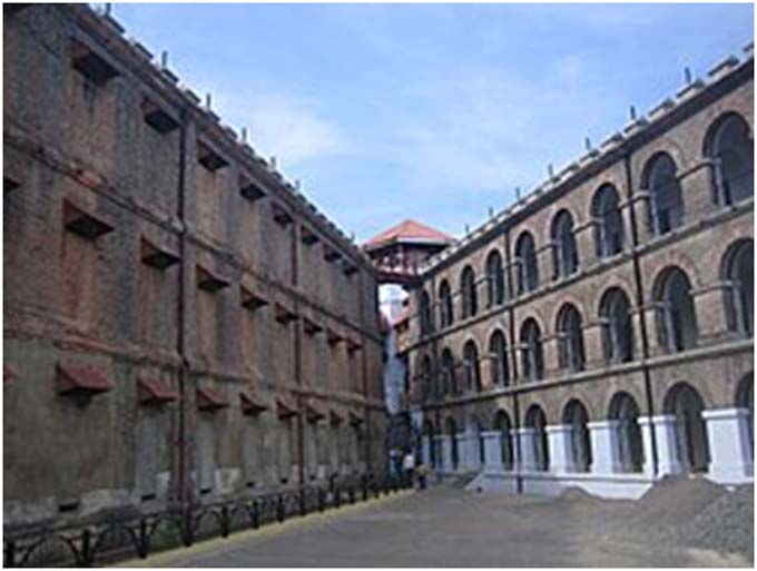
In February 1858, the British re-established a colony in Port Blair. Some years later in 1868, Denmark sold the rights of the Nicobar Islands to the British. In 1872, the Andaman and Nicobar Islands were united under a single command and were administered from Port Blair. The Cellular Jail was completed in 1906, where many brave Indians breathed their last for raising their voice against the British.
World War II. During Second World War, the Japanese captured Port Blair in March 1942 and established control over the islands. Japan gave provisional control of the islands to the Azad Hind Fauj in December 1943, though de-facto they retained control over the islands. The Japanese surrendered in 1945, and the British once again assumed control.
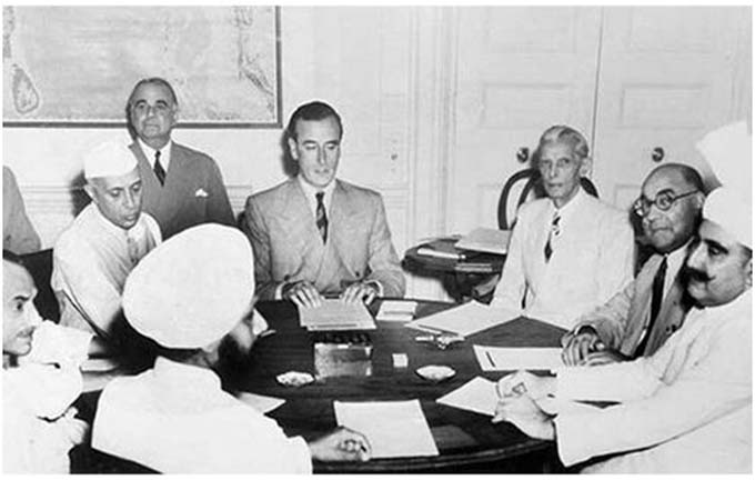
The Conniving British. In the months leading to the Indian Independence the British secretly decided to retain possession of the islands under the garb of resettling Anglo-Indians and Anglo-Burmese on these islands. However, the real reason was the covetous eyes of British defence planners. The Imperial General Staff wanted to detach the islands from India because of their strategic location. In July 1946 the British Service Chiefs in India, prepared a paper on the strategic implications of Indian independence. The Chiefs of Staff argued that “if the British step out, we can expect the Russians to step in. In such an eventuality, it would still be possible to maintain imperial maritime communications via the Cape route. However, air communications would present greater difficulties. New routes could be developed by building a string of air bases in the Indian Ocean islands – Seychelles, Diego Garcia, Ceylon, the Cocos and the Andamans.” The Service Chiefs maintained that Andaman and Nicobar Islands were invaluable in this context. If detached from India, they could provide the bases required for maintaining the lines of sea and air communications with Malaya, New Zealand, Australia and the Far East. As a result of this advocacy, the first draft of the Indian Independence Bill, contained a clause that provided for detaching the islands from British India (before the transfer of power) through an Order in Council. The clause stipulated that the Andaman and Nicobar Islands “shall cease to be part of India.” Thus in May 1947, when a draft announcement of India’s independence was prepared, the document contained no reference to the Andaman and Nicobar Islands.
The claim about an Indian cartographer having spotted the omission is rooted in historical fact. He noted the omission of the Andaman and Nicobar Islands from the proposed map and transfer documents. News of the omission was leaked to the press, and a report appeared in the Times of India on 09 June 1947, saying “It is reliably understood that the Andaman and Nicobar Islands are to be ceded to British Government under the new arrangements.” The Viceroy warned London that a move to detach the islands would “cause an absolute flare-up across the length and breath of India” In light of his advice, the India and Burma Committee of the British Cabinet finally decided, on 17 June 1947, that it was not possible to pursue the suggestion for detaching the Andaman and Nicobar Islands from India.
The Muslim League’s Objection. The allocation of the Andaman and Nicobar Islands to India drew a strong protest from Mr Muhammad Ali Jinnah and the Muslim League. A Muslim league delegation called on the Viceroy, to point out that India would be in a position to prevent overland movement of troops between West and East Pakistan by denying passage through her territory. The only available alternative was movement by sea, and even this would not be possible unless the Andamans were given to Pakistan. Jinnah laid claim to the Andaman and Nicobar islands on strategic grounds, brushing aside the fact that the islands had a negligible Muslim population. However, the request was turned down and the Andaman and Nicobar Islands became part of the Republic of India, while the Preparis Island and Coco Islands became part of Burma.
Current Status
As per the Constitution of India, the Islands were to be administered by a Lieutenant Governor appointed by the GoI. Later, in 1956 the islands became a Union Territory. Since the 1980s, the islands have been developed into a key defence establishment, due to their strategic location in the Bay of Bengal across the Strait of Malacca. The Tri-Service Andaman and Nicobar Command based at Port Blair, is responsible for the defence of the islands.
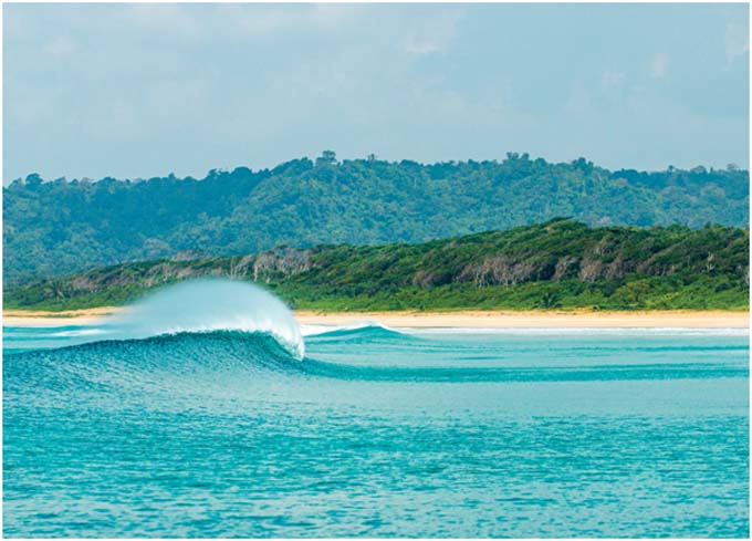
Andamans: Geo Strategic Significance
The location of the Andamans was the very reason that the British Chiefs of Staff, were vying to retain control over the islands way back in 1947. It was also for the same reason that Muhammad Ali Jinnah continued his struggle to have the islands transferred to Pakistan. Why is it that 79 years later, some citizens of the very country, that fought and succeeded in retaining the islands as its sovereign territory, are now questioning its strategic relevance? In fact, the question that needs to be asked is, that why did it take so long to understand the strategic relevance, and why did India not use the Andamans to project its power deep into the Bay of Bengal and Indian Ocean, by building strong military, naval and air assets, decades ago?
Diego Garcia is a striking example of strategic foresight. Acquired in 1965, by the early 1970s, the island had been developed into a joint UK–US military base after the forced removal of the local Chagossian population. It lies about 1,796 kilometres southwest of India. Despite its remote location, it serves as a major hub for military operations, logistics, and power projection across multiple regions. This is how strategic foresight and political will can be employed in support of national interests.
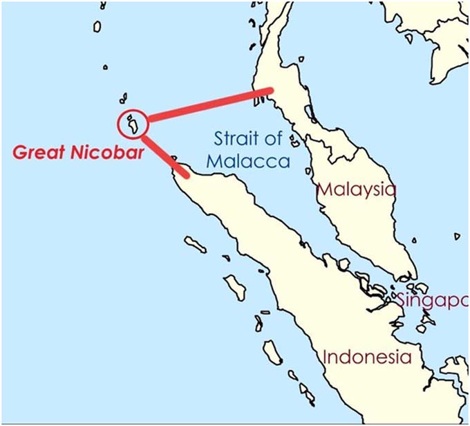
The Andamans are a huge gift of geography to India. The Southernmost Island of Great Nicobar, often termed as an unsinkable aircraft carrier, sits in the Bay of Bengal, more than 1600 Km from Indian mainland and 145 Km from the northern entry to Straits of Malacca. It dominates the sea lines of communication (SLOCs) that are crossing from the Strait of Malacca to Europe, the South Asian landmass, West Asia, Africa, the Cape of Good Hope and to the island nations of Sri Lanka, Maldives, Seychelles, Mauritius and so on. As also the return traffic towards South East Asia, China, Korea, Japan, Australia, New Zealand, and the Pacific Ocean. India must capitalise on this strategic positioning, by building and creating assets that afford India the leverage of exercising effective control over the SLOCs. These SLOCs and straits are among the busiest chokepoints in the world, carrying a large share of global container traffic and energy flows between the Indian Ocean and Pacific Ocean.
The Great Nicobar serves as an anchor at the gates of the Indian and Pacific Oceans. By leveraging the island’s location, dominating the Six Degree Channel and the western approaches to the Straits of Malacca and Singapore, India can position itself as a world power. Great Nicobar’s location provides a deep-water port just off the main east-west shipping routes, allowing large vessels to call at the island without major deviation from their routes, for rest, repair, refit. For the seafarers it will transform into an oasis in the ocean. India, in turn will stand to gain in every way, as the island will becomes a forward point from where India can monitor the flow of goods, capital, and connectivity through the region. It would also be alligned to India’s Act East Policy whereby future economic growth and security would depend heavily on linkages with Southeast Asia.
A careful look at the map shows the displacement of the Andamans from the Indian mainland. Great Nicobar Island is about 2,132 km from Chennai and 2,306 km from Kolkata. The Andamans are also ideally located for the storage of key strategic assets and weapon systems, thereby adding distance from our potential adversaries. The basic security architecture and infrastructure is already in place with raising of the Tri-Service Andaman and Nicobar Command (ANC), however, value accretions are required to meet the additional responsibilities, vulnerabilities and security challenges.
Take for example, INS Baaj, at Cambell Bay. The present runway length of 3000 feet is grossly inadequate to meet the security requirements. The runway should be able to operate the latest fighter, surveillance, and heavylift aircrafts, for which a 10000 feet runway is required. Such value accretions must come up simultaneously if not before the Transshipment port project because security takes precedence.
Thus, the Transshipment project must be developed as joint civil-military project. The civil side can gain from the emmence wealth of specialised and local knowledge that is readily available with the ANC.
Why does China have a “String of Pearls” across the Indian Ocean littoral including Gwadar, Hambantota, Kyaukphyu, BNS Sheikh Hasina Naval Base, Mongla Port (Bangladesh), the Maldives, Cambodia’s Ream, and Djibouti? Do they represent a commercial investment or a sustained effort to expand strategic options across the Indian Ocean. The potential of military utility of these facilities (though limited currently), is enormous. Those entrusted with the responsibility of the country’s security are aware that hostile strategic infrastructure in its immediate neighbourhood is not merely another commercial investment.
In view of this, India cannot afford to leave its easternmost flank demilitarised and underdeveloped. It is probably with this and commercial benefits that will accrue in mind, that India is developing an infrastructure project in Great Nicobar, which while catering for civilian requirements, will cater to the needs of the defence establishment, to support the deployment of additional troops, warships, aircraft, and missile systems, hardened fuel and ammunition storage, surveillance, thus enhancing military deterrence essential for national security. Building of such defence infrastructure will provide inherent protection to the Transshipment Port Project, which is essential for its security and smooth functioning.
The Great Nicobar Island Development Project
The Great Nicobar Island at the southern tip of the Andamans is not merely an island but an instrument of state power, enabling India to project influence over the busiest SLOCs stretching across the eastern Indian Ocean. The location, on the mouth of the Malacca Strait, overlooks one of the busiest sea lanes, through which the world’s energy is transported in the form of crude oil and gas, from the Gulf, the African coast and South America.
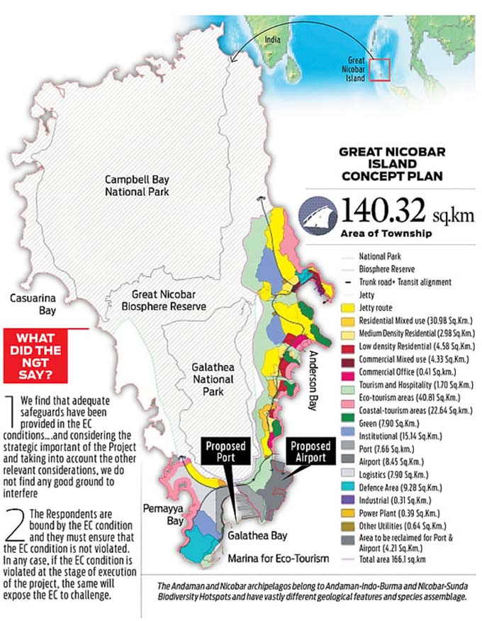
Recognising this advantage, the Government of India is developing infrastructure, named the Great Nicobar Island Development Project. The project is both economic and strategic. India currently depends heavily on foreign ports, particularly Singapore and Colombo, for Transshipment. Developing a domestic facility near Malacca would reduce this dependence, while positioning India as a major player in regional maritime trade and enhancing strategic depth.
The long-term plan is to develop the island as a major international container Transshipment hub. The International Container Transshipment Port (ICTP) at Galathea Bay is the core of the plan. It is designed to handle ultra-large container ships that currently call at hubs like Singapore, Colombo, or Port Klang. The ICTP will also have a greenfield international airport to support both civil and military air traffic, a 450 MVA power plant based on gas and renewable energy, and a township to house port workers, logistics staff, and their families, with schools and hospitals, included.
Presently significant revenue is being earned by foreign shipping companies by way of the transfer of containers from Singapore’s Transshipment port to Indian destinations. With a container Transshipment terminal on the Indian side, India will stand to earn the revenue that is lost every year by way of Transshipment costs to foreign companies.
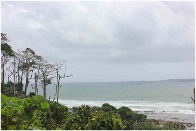
Galathea Bay, offers a natural draught of 20-22 metres, meaning minimal dredging, lower maintenance costs and allowing the world’s largest container ships (18,000-24,000 TEU) to berth easily. The port is planned to be built in phases over 30 years: an initial capacity of around 4 million TEUs per year, with later phases pushing the total to about 14 million TEUs. In comparison, Vizhinjam, India’s first deep water container Transshipment hub, which commenced commercial operations in December 2024, handled about 1.3 million TEUs in its first financial year. Over time, the port can generate employment in logistics, warehousing, cold chains, bunkering, ship repair, maritime finance, and insurance, creating a broader maritime services ecosystem.
Environmental Concerns of the Project
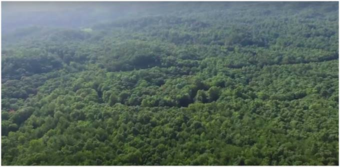
Environmental concerns are a harsh reality. The Nicobar Islands are part of a biodiversity-rich ecological zone, characterised by dense forests, unique wildlife, and fragile marine ecosystems. Large-scale human encroachment could cause deforestation, disrupt habitats, and damage coral reefs, leading to irreversible ecological consequences. A forest cover that has survived for millions of years, being subjected to axe, is bound to have severe adverse effects. The Great Nicobar, is spread over more than 910 square km, comprises primarily of untouched dense rain forest. The proposed project, towards the south-eastern tip of the island, is set to be built over an estimated 166 square km of land, that is 18% of the total land area.
One school of thought, in support of the project, states that the impact on the forest may be significant locally, but tiny regionally. The Andamans cover 674,000 hectares of forest. The project’s 13,075 hectares represent less than two per cent of the total forest cover across all 836 islands. Over 98 per cent of the archipelago’s forests will thus remain untouched. However, this line of argument is far from convincing, as ecological degradation should be island specific and not regional generic.
The project involves large-scale clearing of tropical rainforests, with tree loss potentially exceeding 10 million, risking soil erosion, habitat disruption, and ecological imbalance. This deforestation component covers approximately 130 square km of tropical rainforest out of the total project area of 166 square km. Almost 80% of the land needed for the project is forest land. This includes loop-root and black mangroves near the coast and old-growth trees and ferns in the dense rainforests further inland. Many of the varieties of climbers and shrubs in these forests, including ferns and wild fruit trees, are endemic to the Greater Nicobar Island.
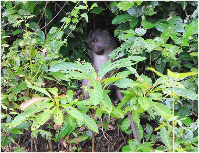
There will obviously be a major impact on wildlife too. The endangered species like the leatherback turtle, Nicobar pigeon, the Nicobar long-tailed macaque, and Nicobar megapode face serious threats due to habitat loss and denotification of the Galathea Bay Wildlife Sanctuary. Wildlife own the island, as they have owned it since time immemorial. They will not understand why one part is suddenly being taken away from them. Even in the past, whenever man has encroached forest areas, it led to widescale extinction of various forms of wildlife.
The Port construction will damage coral reefs and disrupt marine ecosystems, potentially triggering a cascade of biodiversity loss. Coral ecosystems are not just environmental assets; they are part of the physical operating system that helps keep tropical coasts stable and habitable.
A far greater cause of concern, is the displacement of the original human inhabitants of the island. It is said that the Forest Rights Act (2006) provided by the Ministry of Environment, Forest and Climate have been complied with. But, can we take their word for this? The Shompen, (Particularly Vulnerable Tribal Group), are central to the debate. The Shompen are a shy tribe who do not wish any contact with other populations. They have settlements in the Mount Thullier, Laful, and Jhau Nala areas. Their surviving numbers are recorded at 229. Only a few Nicobarese can speak/understand their language, and therefore addressing their concerns and apprehensions, will be difficult. They are semi-nomadic and survive on forest produce. To preserve the tribe as they are, no one enters the Shompen habitation zones. However, some Shompen are known to frequent the Galathea Bay area while foraging/hunting. Contact with humans involved with port activities could lead to catastrophic consequences. It is important to note that the total population of Shompen has been reducing, due to reduced number of females and intra-tribe marriages.
While the protection of habitat and tribal rights of the Shompen is important, there is also a need to show concern for the Nicobarese Tribe. The known number of surviving Nicobarese (Little Nicobar and Great Nicobar) is 892, although their combined population over the islands is close to 30,000. The Nicobarese are semi-modernised, and move between their original habitats of Car Nicobar, Nancowry and the Little Andaman Islands. To increase the number of main stream population in Great Nicobar, the government in the late 60s began a resettlement programme in which 69 ex-servicemen families were settled in April 1969. Subsequently, larger numbers in the 70s, were settled in various parts of this island. They and their families continue to live on the island. Their main occupation is agriculture. The Nicobarese along with these additional settlers (approximately 8,138 residents), occupy coastal areas, constitute small populations that are culturally distinct and vulnerable. Therefore, no arbitrary development should be carried out on the Nicobar Islands. The island(s) are home to indigenous communities and resettled ex-servicemen whose protection and survival is at stake. Any large-scale development will pose various risks to their way of life.
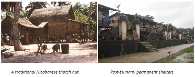
The Andamans are located in a seismic zone, with high earthquake and tsunami risks. The last major tsunami to strike the Andaman & Nicobar Islands was on 26 December 2004. It devastated the Nicobar Islands in particular, submerging land, destroying villages, and killing nearly 2,000 people with thousands more missing. Thus, on an island such as Great Nicobar, with tectonic instability, extreme weather exposure, and coastal fragility it is only logical to question the long-term resilience and sustainability of the infrastructure planned to be built.
Recommendations for the Way Ahead
(a) Security Concerns Override.
China has established their presence in Djibouti, Gwadar, Maldives, Hambantota, Kyaukphyu, BNS Sheikh Hasina Naval Base, Mongla Port (Bangladesh), and Cambodia’s Ream. However, to access to these ports, China has to enter the Indian Ocean only through the available straits. The relevance of a “strait” has been more than established during the recent US-Iran war by the closure of the Strait of Hormuz. Geography has blessed India in the form of the Great Nicobar Island, that suddenly breaks water at the entrance to the Strait of Malacca. Why would India not use this gift of geography in its favour? India has to have substantial Military presence and capability in the Andamans in general and Nicobar in particular. We have to dominate both the 6-Degree Channel and the 10-Degree Channel. This is the point at which India can assert itself in case of an adverse situation building up in the Himalayas. Hence the military aspect, and the necessity of dual use infrastructure.
There are two important military related aspects. Firstly, the Andamans will be a projection of Indian Military power in the Eastern Indian Ocean in general, and over the Straits of Malacca in particular. The second part is the defence of the island territories. If both the projection and defence have to be viable, it is axiomatic that there would be a requirement for boots on ground, aircraft in the air, and battleships in the ocean. Therefore, first and foremost there is a requirement of a detailed Defence and Maritime Strategy (DMS), laying down the overall strategic foresight of how these two aspects are to be achieved, giving out exact force levels, locations, and contingency planning. It will be this document, along with the associated infrastructure and military hardware, that will be the very foundation on which the Transshipment hub can be developed as a successful commercial enterprise. The DMS thus prepared has to be all encompassing, covering the entire Indian Ocean including the Lakshadweep and Andaman group of islands and various aspects of force projection. The Transshipment hub should be part of the DMS to ensure its inherent security.
Captain (Dr) Gurpreet S. Khurana, Indian Navy (Retd), former Executive Director of the National Maritime Foundation, writes of a maritime strategy that would ask not merely “how do we defend Great Nicobar” but “what kind of maritime nation does India intend to be, and what infrastructure, institutions, legal frameworks, and diplomatic architectures does that require?” Rear Admiral Sudhir Pillai, (Retd), in his paper, The Crow’s Nest and the Continental Mind, examines the challenge of sustaining distant island territories; and the interaction of sea, air, and land power across constrained maritime theatres. He says, these are no longer matters confined to naval planning staffs alone. They increasingly shape trade, infrastructure, logistics, environmental governance, and India’s wider Indo-Pacific and oceans postures. India needs to spell out its strategic objectives before the project commences.
(b) Necessity of the ICTP.
The Indian Ocean will define the 21st century. The Great Nicobar positions India at the centre of that future. Approximately ninety-five percent of India’s trade by volume moves by sea. The Great Nicobar Island is just 22 nautical miles north of the international shipping lanes passing through the 6-Degree Channel. The location in terms of proximity to the shipping lanes couldn’t be more significant. The SLOCs and geography dictate that a strong Indian presence at the southern tip of the Andaman & Nicobar chain is a strategic necessity.
However, the island is displaced from mainland India by more than 720 nautical miles. Therefore, all logistical requirements will have to be generated and sustained across these 720 nautical miles, as there is absolutely nothing available on the island. This will come at a cost and advance planning. As the project takes shape these requirements and costs will only increase. One has to address the seismic concerns, the weather constraints, the non-availability of building material/labour and more. All this will result in sky-rocketing of construction costs. And the most difficult question will remain – will it work? India cannot afford to build something that won’t work, especially with the enormous cost involved.
So why build a Transshipment hub so far from the Indian mainland at four times the construction cost, when Colombo, or Vizhinjam are already available? The answer lies understanding how a Transshipment hub works. Transshipment hubs depend on shipping lanes. The Great Nicobar sits just 22 nautical miles north of the east-west maritime trunk route, the busiest container corridor in the world. In contrast, Colombo, and Vizhinjam require significant deviation from this trunk line. Every deviation for a 20,000 TEU container ship, comes with an additional cost, in terms of fuel consumption, and turnaround time. The Great Nicobar eliminates that deviation, and the commercial viability is evident for all to see. In addition, Galathea Bay, offers a natural draught of 20-22 metres, allowing the world’s largest container ships (18,000-24,000 TEU) to berth easily. Therefore, the project needs to be marketed, well before it starts, and an in-depth market survey is mandated to ensure the commercial viability of the project, as well as to justify the huge costs involved. The ICTP should be considered as a national investment for India’s security, economy and the country’s place in the same ocean that has been named after it.
(c) Who is Best Suited to Construct the ICTP.
As stated earlier, the Defence and Maritime Strategy, should include the Transshipment hub, as part of the overall strategy. If so, a number of facilities being constructed would ab initio be planned for dual use.
The ICTP at Great Nicobar is going to be India’s largest port project once completed. It will be designed to handle 14.2 million TEUs annually, which will be significantly higher than the next largest, Jawaharlal Nehru Port Trust, Mumbai, which handles around 5–6 million TEUs a year.
It is therefore obvious that the construction of such an important and futuristic port should be entrusted to the most capable agency that is available in India.
Syama Prasad Mookerjee Port (SMPK), Kolkata is the nominated nodal agency for the development of the ICTP at Galathea Bay, Great Nicobar. It has been entrusted with planning, inviting bids, and overseeing the construction and eventual operation of the port under a landlord model. Commissioned in 1870, SMPK is India’s oldest major port. The SMPK has extensive experience in port development and modernization, having managed major terminals, cargo expansion projects, and infrastructure upgrades at both the Kolkata Dock System and Haldia Dock Complex. Therefore, it may be well-positioned to lead large-scale initiatives like the ICTP at Great Nicobar. However, the Syama Prasad Mookerjee Port, Kolkata is an inland waterways port. It is India’s only major riverine port, situated about 232 km upstream from the sea along the Hooghly.
While SMPK is the nodal agency, the Andaman and Nicobar Islands Integrated Development Corporation (ANIIDCO), is to act as a local coordinating/implementation agency between the Union Territory administration, and central government bodies, like the Ministry of Ports, Shipping & Waterways and SMPK. Its role is to ensure smooth implementation of infrastructure projects while safeguarding local interests. (Another report states that ANIIDCO, not SMPK, is the nodal agency, tasked with overseeing the development of the ICTP). ANIIDCO has a diverse track record in the Andaman & Nicobar Islands, ranging from alcohol distribution, tourism promotion, agro-industrial projects, to essential services like petroleum distribution and dairy production. Its past projects include tourist resorts, milk plants, petroleum supply chains, and handicraft promotion, making it a key development agency.
The implementing agency of the ICTP must be one, whose capacity matches the project’s ambition, of being an extension of India’s strategic outreach, as well as the largest container transshipment port in the Indian Ocean. It should be headed by an officer who has the technical knowledge and the experience of handling such large-scale marine projects. Civil or Military, the officer should be part of the DMS preparation so that the strategy is aptly executed on ground.

(d) Environmental Resolutions.
While strategic imperatives cannot be ignored, neither can the environmental issues. Environmental safeguards have to be strengthened, impact assessments studied, and the indigenous communities involved and protected. The islands contain the original face of the earth as God made it.
The tribal areas must be demarcated and closed for tourism. Let the tribals live without any interference, specially the Shompens, as they have lived for centuries. Do not introduce health-care access, or emergency evacuation or forest-based livelihood support, they have survived without them and will continue to survive without these. Imposing so-called essential services will surely adversely affect their way of life.
A home and hearth model could be developed, by creating a Tribal cum Forest protection force, consisting only of indigenous people, (other than the Shompens), including the families of the ex-servicemen who came and settled in the 60s and 70s. They could be recruited and trained locally by the Territorial Army Battalion already in place. The Nicobaris who are educated and largely in the mainstream could be given skill-sets that would make them suitable for employment in the ICTP.
A foolproof conservation programme has to be put into place, prior to the bricks and mortar. Even though a number of studies have been carried out, another deep study by nominated experts is recommended, to assess the damage to the flora and fauna of the island. Even though only 18% of the island on the Southern side towards Indira point is being developed, there will be substantial impact on the rain forest, the exquisite plants and the endangered animal species, and off-course the Shompens. All adverse effects can only be offset by a dedicated team of experts suitably kitted and armed with local knowledge. There are many modern methods of conservation which should be accorded top priority like, Light shielding, noise buffers and seasonal restrictions.
Seismic Risks have been addressed in the planning stage. Ports and airports operate safely in seismic zones worldwide. The project has to use Zone V-compliant engineering, tsunami modelling and coastal resilience planning. Seismic risks can thus be avoided through design and modern technology. There are many countries in the world that are in active seismic zones, but have learnt how to minimise loss to property and life.
Conclusion
The Great Nicobar Island needs to be visited to understand that world. It is different, it is remote, it is even scary, it is frozen back in time. Survival is a struggle, as basic human necessities are not available. Everything has to come from the Indian mainland, across the Bay of Bengal, the crossing imposing its own challenges.
There is only one petrol pump on the Great Nicobar Island, which is sometimes subjected to queues of two-wheelers lined up for fuel. Mind you, there are only a handful of people who live there, and less than a handful of motorised transport users/owners and to add hardly any roads. Then also rationing of fuel is sometimes resorted to, because the next supply of petrol is expected from a ship that is waiting for favourable weather conditions at Car Nicobar, the district headquarters.
During the summer months, the availability of drinking water is an issue. Supply comes once every three to four days. These are the problems, when the population of the island is just about 8,000 people.
Therefore, the logistical problems will increase manifold when labour and staff will start arriving on the island during the construction phase of the project. Islanders are naturally concerned about whether the island has the capacity to sustain large-scale development. Prior to commencement of the project, a lot of homework in terms of logistic planning will have to be undertaken. This cannot be a project undertaken in haste and exuberance, as that will result in a catastrophe even before it starts.
It is strongly recommended that to begin with, the project be solely a military and commercial enterprise. The tourism portion may be added to the project once everything else falls into place. There were whispers in the corridors that the island will be developed as an “alternative to Hong Kong.” Such dreams often enter the minds of the uninitiated, who are divorced from reality.
While, as stated with ample conviction that the project is a strategic necessity, there is also a fine balance that needs to be borne in mind as has been brought out. Therefore, the project needs to be thought through by the most carefully selected competent officers, including those heading the most technically sound construction agencies. It cannot be viewed in isolation but needs a whole of nation approach with experts from diverse backgrounds to examine all relevant issues.
Acknowledgements
Lt Gen AK Singh
Lt Gen Rajeev Chaudhary
Mr KM Pannikar
Col Guru Saday Batabyal (Retd)
Mr Ullattil Manmadhan
C Dasgupta IFS (Retd)
Rear Admiral Sudhir Pillai (Retd)
Vice Admiral RB Pandit (Retd)
Lt Gen Ajai Singh (Retd)
Captain (Dr) Gurpreet S. Khurana (Retd)
ABOUT THE AUTHOR
 Maj Gen VK Singh, VSM was commissioned into The Scinde Horse in Dec 1983. The officer has commanded an Independent Recce Sqn in the desert sector, and has the distinction of being the first Armoured Corps Officer to command an Assam Rifles Battalion in Counter Insurgency Operations in Manipur and Nagaland, as well as the first General Cadre Officer to command a Strategic Forces Brigade. He then commanded 12 Infantry Division (RAPID) in Western Sector. The General is a fourth generation army officer.
 Major General Jagatbir Singh was commissioned into 18 Cavalry in December 1981. During his 38 years of service in the Army he has held various command, staff and instructional appointments and served in varied terrains in the country. He has served in a United Nations Peace Keeping Mission as a Military Observer in Iraq and Kuwait. He has been an instructor to Indian Military Academy and the Defence Services Staff College, Wellington. He is a prolific writer in defence & national security and adept at public speaking.