
The Road that Entered the Forest
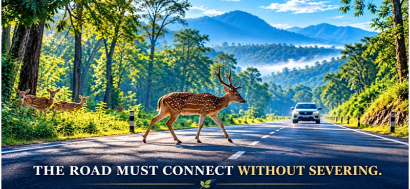
At first light, a forest road can look almost innocent. The asphalt is narrow, the traffic sparse, and the trees appear to close over it from both sides. Yet for an animal moving between feeding grounds, water and cover, that strip of asphalt can become a deadly divide. A deer crossing at dusk does not understand a speed limit; a leopard following its habitual route does not recognise a sanctuary boundary; a snake moving towards water cannot anticipate headlights. The tragedy is usually reduced to a carcass beside a road, but the carcass is only the visible end of a much larger ecological disturbance.
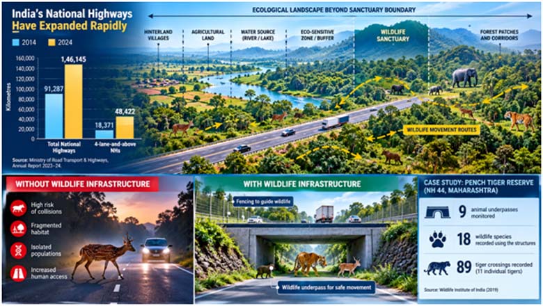
India is building roads at a remarkable pace. The national highway network grew from 91,287 km in 2014 to 1,46,145 km in 2024, a 60 per cent increase; four-lane-and-above highways expanded from 18,371 km to 48,422 km. This is essential infrastructure for a growing economy.
But when roads enter the hinterland of wildlife sanctuaries, connectivity for humans can become fragmentation for wildlife.
The Sanctuary is no Longer an Island
India’s protected-area network has expanded into a substantial ecological safety net. The Ministry of Environment, Forest and Climate Change currently lists 987 protected areas: 106 national parks, 564 wildlife sanctuaries, 99 conservation reserves and 218 community reserves. The point, however, is not the number of protected areas but their relationship with the landscapes around them.
A sanctuary is legally defined; an ecosystem is not. Animals cross boundaries every day in search of food, water, mates and seasonal shelter. Rivers, ridges, agricultural fields, village commons and forest patches can form one functional landscape even when administrative maps divide it into different categories. This is why the hinterland matters. A road ten kilometres from a sanctuary may be as important to an animal population as a road at its gate if it intersects a habitual movement route.
This distinction matters in the hinterland, where protected areas are embedded within productive landscapes. A sanctuary may occupy only one portion of an animal’s home range, while adjoining forests, farms, streams and scrublands provide resources. Protecting the legal boundary while degrading the movement network can preserve a sanctuary while weakening the ecosystem.
The Hinterland Problem
The most visible conservation debates often surround celebrated tiger reserves and national parks. Yet hundreds of smaller sanctuaries lie amid India’s working countryside, where roads serve villages, farms, markets, schools, tourism and local industry. Their roads may not carry the spectacular traffic of a major expressway, but cumulative traffic can still create repeated wildlife mortality.
The problem becomes sharper when a district road is widened, a state highway is upgraded, a bypass is constructed, or a new economic corridor changes traffic patterns. A road that was once quiet may become a fast-moving transport artery without the surrounding ecological system changing at all. The sanctuary remains where it was; the animals remain dependent on the same landscape; only the risk has changed.
This is why road planning near hinterland sanctuaries must look beyond the carriageway. The relevant question is not simply whether a project passes through protected land, but whether it interferes with the ecological functioning of the landscape.
What the Roadkill Map Reveals
For years, India knew far more about human casualties on roads than animal casualties. The India Roadkill Monitoring Project is beginning to close that information gap. Its latest GBIF dataset contains 491 occurrence records, with citizen-science observations collected between 2018 and 2025 across ten states and systematic surveys undertaken in Amravati district during 2021–22. The project’s live platform currently displays more than 236 mammal, 144 bird, 287 reptile and 21 amphibian records, illustrating how broad the taxonomic footprint can be.
The Amravati experience is particularly instructive. A systematic survey covering 10,500 km of road network in 2022 recorded 364 roadkills representing 70 species, of which 336 were wild animals and 28 domestic. These figures should not be extrapolated to the whole country: citizen-science datasets have spatial and temporal biases, and many carcasses are never reported. Their value lies elsewhere. They show where mortality is occurring and provide a starting point for identifying patterns that conventional road statistics simply do not capture.
The Invisible Cost of Connectivity
Roadkill is the most obvious consequence, but it is not necessarily the most important one. A road can divide feeding areas from water sources, separate breeding sites from shelter, increase noise and artificial light, facilitate human access, and create barriers that animals are reluctant to cross. For small populations, repeated mortality can gradually remove breeding individuals; for others, fragmentation can isolate groups even when no single roadkill event appears significant.
A 2025 study from the Nelliyampathy Hills in Kerala illustrates the scale that can remain invisible without systematic observation. Researchers recorded 330 roadkills during 22 surveys along a 50-km transect, covering 72 species. Reptiles accounted for 228 individuals, amphibians 70, mammals 23 and birds nine. The researchers estimated annual roadkill at 5,490 animals along the transect. Such findings are a reminder that counting only charismatic mammals dramatically understates the ecological cost.
The lesson is simple: the absence of dramatic carcasses does not mean the absence of ecological impact.
From Wildlife Passages to Wildlife Infrastructure
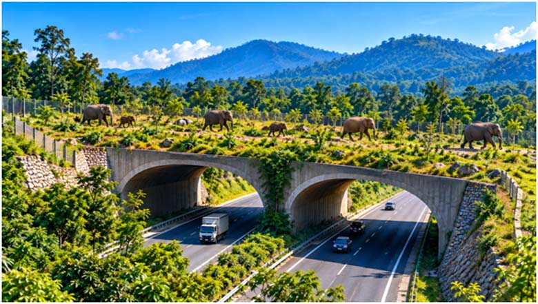
Fortunately, this is not a problem without engineering solutions. Wildlife crossings can be designed as underpasses, overpasses, modified culverts, canopy bridges and other structures suited to particular species and terrain. Fencing can guide animals towards safe crossings; speed management can reduce collision risk; warning systems can alert drivers at known crossing points.
India already has evidence that such infrastructure can work. The Wildlife Institute of India monitored nine animal underpasses on National Highway 44 through Pench Tiger Reserve in Maharashtra in 2019. Camera traps recorded 18 species using the structures, including spotted deer, gaur, nilgai, sambar, wild pig, leopard, sloth bear, jackal, wild dog and tiger. Six of the nine structures recorded 89 tiger crossings involving 11 individual tigers.
The important shift is therefore from treating wildlife mitigation as an environmental add-on to treating it as part of highway engineering.
It also means that mitigation must be species-specific. What works for a tiger may be unsuitable for amphibians, reptiles or arboreal mammals. Engineering must therefore follow ecology, not simply install standard structures at convenient locations.
From Sanctuary Boundary to Ecological Buffer
India already recognises the need for a transition zone around protected areas through the concept of Eco-Sensitive Zones. The Ministry describes these areas as a kind of “shock absorber” between highly protected ecosystems and areas where regulated development may occur. As reported in its 2024–25 annual report, 347 final ESZ notifications covered 488 protected areas, extending over 72,256.17 sq km.
But a regulatory buffer and an ecological buffer are not necessarily identical. Animals do not consult notification maps before crossing a road. A sanctuary may depend upon a water body, forest patch, grassland or corridor outside its formal boundary. Consequently, infrastructure planning should identify an ecological influence zone around vulnerable sanctuaries, based on animal movement, habitat connectivity, water availability, seasonal use and observed roadkill.
This should be a planning tool rather than another layer of bureaucracy.
A Roadmap for Roadkill-Safe Highway Framework
The solution can begin with five practical changes.
- Map before Alignment. Wildlife movement should be mapped before finalising road alignments, particularly for projects near sanctuaries.
- Identify Wildlife Movement Corridors. Roadkill records should become engineering data: recurring hotspots should trigger site investigations rather than merely annual reporting.
- Engineer Crossings into the Original DPRs. Crossings, fencing, drainage modifications and speed-control measures should be incorporated into the DPR and project cost from the beginning. Crossings should be intelligently designed to guide animals through safe passages.
- Monitor continuously after Commissioning. Mitigation should be monitored after commissioning. A crossing structure is not successful merely because it exists; camera traps and field surveys must establish whether the intended species actually use it.
- Make Roadkill Data Publicly Usable. India needs an integrated national roadkill database linking MoRTH, MoEFCC, State forest departments, NHAI, research institutions, local administrations and citizen observations,
The objective is not to stop development. It is to make ecological intelligence part of development.
The Road Ahead
India cannot choose between roads and wildlife. Rural communities need connectivity; farmers need markets; tourism needs access; industry needs logistics; strategic regions need reliable infrastructure. The question is whether every kilometre of new infrastructure must carry an invisible ecological cost.
The answer should be a better definition of connectivity. A road should connect settlements without unnecessarily disconnecting habitats. A bridge should carry traffic while allowing animals to move beneath it. A culvert should manage water while remaining usable by wildlife. A highway should be measured not only by kilometres constructed, travel time saved and traffic carried, but also by whether it preserves the living landscape through which it passes.
The future of India’s hinterland will not be decided only by how many roads we build. It will also be decided by whether we understand the landscape those roads cross.
The finest road is not the one that merely gets us there faster; it is the one that gets us there without making the wild pay the price.
ABOUT THE AUTHOR

Lt Gen Rajeev Chaudhry (Retd) is a social observer and writes on contemporary national and international issues, strategic implications of infrastructure development towards national power, geo-moral dimension of international relations and leadership nuances in changing social construct.