For millennia, the Himalayas stood as the Great Barrier—a silent, impenetrable wall of ice and granite that dictated the limits of empires. Today, that silence is broken by the roar of heavy machinery and the precision of laser-guided drills. In 2025, the 3,488-kilometer Line of Actual Control (LAC) has transitioned from a remote, seasonally-monitored boundary into the most active infrastructure race track on the planet. This is no longer a mere border dispute; it is a high-altitude industrial duel where bitumen and concrete have become the primary tools of national sovereignty.
On 7 December 2025, Defence Minister Rajnath Singh dedicated 125 Border Roads Organisation projects from Leh — a package of 28 roads, 93 bridges, Shyok tunnel and three miscellaneous works valued at roughly ₹4,737 crore and spanning Ladakh, J&K and seven other border states — underscoring New Delhi’s push to close critical access gaps on the northern frontier.
The Topographical Asymmetry.
The contest is defined by a fundamental geographical paradox. To the north, China operates from the Tibetan Plateau—a high-altitude tableland that allowed for the rapid, lateral deployment of the G219 and G318 super-highways. This plateau gave Beijing a multi-decade head start, allowing the People’s Liberation Army (PLA) to achieve logistical saturation with ease. China retains a structural advantage in scale and redundancy.
To reach the same frontier, Indian engineers must ascend vertically from the humid plains of the Brahmaputra and the Ganges, carving roads into unstable shale, tunnelling through fragile mountain strata, and bridging deep, tectonic gorges. For decades, this tyranny of terrain forced India into a defensive, reactive posture.
The Galwan Conflict: Infrastructure as Deterrence.
The post Galwan paradigm shift has seen India abandon its policy of strategic neglect in favour of mission-mode modernization through huge focus on Last Mile Connectivity. Through the PM GatiShakti framework and the critical strategic projects, India is overcoming the Himalayan Watershed Challenge and neutralizing China’s geographic advantage. The completion of the Third Axis to Ladakh, the saturation of the Eastern Sector with all-weather tunnels and upgraded airfields, signify a shift from presence to logistical parity. Vibrant Villages are countering China’s Xiaokang outposts. The control of the Himalayan Watershed is going to be the ultimate battle for the headwaters of Asia. In this theatre, the bridge is as vital as the battalion, and the tunnel is as strategic as the tank regiment. The race is on to see who can command the crest of the continent, not just in summer, but through the isolation of the Himalayan winters.
The Strategic Stakes.
In the post-Galwan era, the Himalayan Watershed has transitioned from a remote geographical barrier into the world’s highest logistical front line. The strategic stakes are no longer defined by simple territorial presence, but by operational persistence—the ability to maintain and move large-scale military assets across the crest of Asia throughout the brutal winters. China’s Tableland Advantage was built on the relatively flat Tibetan Plateau, allowing for rapid lateral movement via the G219 highway. This created a profound Infrastructure Asymmetry, where Beijing could mobilize divisions in days while New Delhi struggled with weeks of mountain induction.
Today, India’s response has evolved into a doctrine of logistical deterrence. By treating bitumen and concrete as Force Multipliers, India is neutralizing China’s head start. The stakes involve more than just military mobility; they encompass Hydro-Digital Sovereignty. With 2025 seeing a surge in high-altitude dams and 4G saturation, the country that secures the watershed secures the headwaters of Asia’s major rivers and the data-links for its future AI-enabled defences. The race to bridge the last mile is, therefore, a race to secure the very Water Tower of the continent, ensuring that India’s northern frontier is not just a line of defence, but a fortress of connectivity.
Road Networks—The Arteries of the LAC.
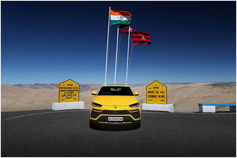
In the strategic geography of 2025, road networks have become the lifeblood of the LAC, serving as the primary mechanism for Rapid Force Induction. China’s dominance is anchored by the G219 and G318 Strategic Backbone Channels, massive lateral highways on the Tibetan Plateau that allow the PLA to shift armoured divisions across sectors in under 72 hours. While China utilizes automated road-laying robots capable of paving up to 15 km daily, India has countered this Speed Gap through a massive scale-up of the India-China Border Roads (ICBR) Phase III. Post Galwan, India’s crowning achievement is the full operationalization of the Nimmu-Padum-Darcha (NPD) axis. As the Third Axis to Ladakh, the NPD road provides a shorter, more protected route that avoids the Line of Sight from enemy artillery, reducing travel time from the hinterland to the border by nearly 40%. Complementing this is the Darbuk-Shyok-Daulat Beg Oldie (DSDBO) road, which has been upgraded to all-weather status, ensuring that India’s northernmost outpost at the base of the Karakoram is never isolated. By shifting from manual labour to high-altitude state-of-the-art rock-pulverisers, the BRO has narrowed the construction divide, ensuring that every kilometre of blacktop acts as a permanent deterrent against territorial erosion.

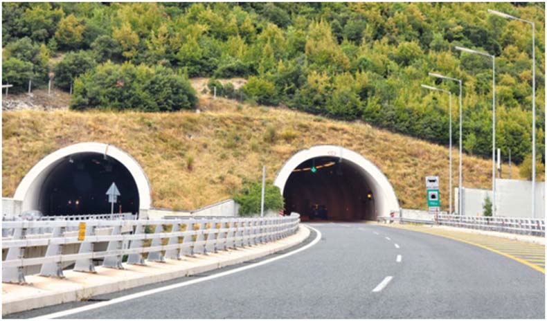
The War of Tunnels—All-Weather Dominance.
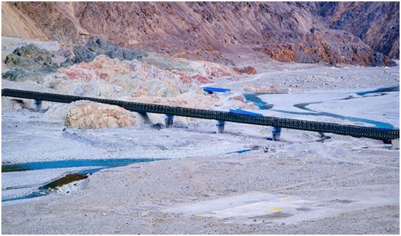
In the strategic high-stakes, tunnels have transitioned from being engineering luxuries to becoming the absolute guarantors of national sovereignty. While surface roads are prone to seasonal paralysis due to avalanches and heavy snow, India’s War of Tunnels aims to provide 365-days logistical continuity. The centrepieces of this revolution are the Zoji La and Shinku La projects. As of December 2025, the Zoji La Tunnel—Asia’s longest tunnel at 14.15 km—is over 75% complete. By bypassing the treacherous Zoji La pass, it will neutralize the winter isolation that once hampered troop induction.
Simultaneously, the Shinku La Tunnel (4.1 km) will soon become a global engineering benchmark. Situated at a staggering 15,800 feet, it will be the highest motorable tunnel in the world, serving as the final plug for the NPD axis. These subterranean corridors do more than just facilitate movement; they provide stealth transit for heavy armour and missile systems, shielded from satellite surveillance and enemy fire. By moving the Last Mile underground, India has effectively shifted the tactical advantage, turning the Himalayan winter from a vulnerability into a fortified defensive asset.
Vibrant Villages vs Xiaokang Outposts.
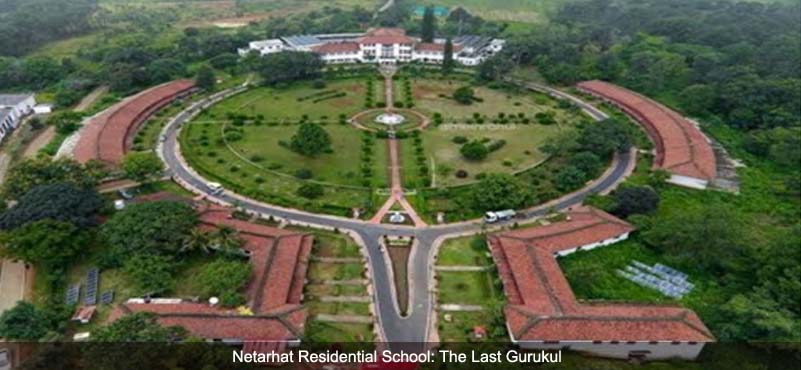
In the strategic architecture of 2025, the Last Mile is no longer just a military outpost; it is a inhabited landscape where civilians serve as soldiers without uniforms. China’s Xiaokang (well-off) villages—over 628 weatherproof, dual-use clusters—have been systematically established near the LAC to create a settled population defence. These villages are effectively military garrisons in civilian disguise, providing the PLA with permanent logistics hubs and a human shield to bolster territorial claims. In response, India has launched the Vibrant Villages Programme (VVP), a ₹4,800 crore strategic initiative (now in its second phase) designed to reverse out-migration and turn border hamlets into thriving hubs of connectivity. India’s strategy focuses on Saturation Development—ensuring 100% 4G telecom coverage, all-weather road access, and 24/7 electrification for 662 first-phase villages.
By promoting Battlefield Tourism (such as the 2025 Bharat Rannbhoomi Darshan in Sikkim) and agro-based value chains, India is creating an economic gravity that keeps its first citizens on the land. Unlike China’s often forced settlements, the VVP leverages democratic hub-and-spoke models where local Gram Panchayats lead the development. This creates a resilient, loyal population that serves as the eyes and ears of the ITBP and Indian Army. In the 2025 Himalayan landscape, the vibrancy of a village is as much a deterrent as the strength of a bunker.
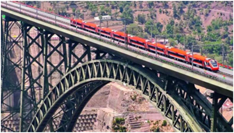
Strategic Rail—The High-Altitude Artery.
In the strategic architecture of 2025, railways are emerging as the ultimate logistical heavy-lifters, capable of moving entire armoured brigades and thousands of tons of ammunition in a fraction of the time required by road convoys. China has doubled down on its Go West strategy, launching the Xinjiang-Tibet Railway—a nearly 2,000 km project that will eventually connect Hotan to Lhasa. As of late 2025, work on the Shigatse-Pelkhu Tso section is advancing at war footing, with parts of the alignment running dangerously close (within 20–30 km) to the Demchok border in Ladakh. This plateau rail network, which Beijing aims to expand to 4,000 km by the end of the year, effectively integrates the LAC into China’s national rapid-response grid. India’s counter-response is cantered on the Bilaspur-Manali-Leh (BML) line, a ₹1.31 lakh crore engineering marvel that is set to become the highest rail network on Earth. By December 2025, the Detailed Project Report (DPR) has been finalized, and construction has fast-tracked on the feeder Bhanupalli-Bilaspur section. The BML line is a vertical masterpiece: over 55% of its 489 km route consists of tunnels (270 km total) to navigate the sheer Himalayan rise. Similarly, in the Eastern Sector, the Bhalukpong-Tenga-Tawang line is undergoing final location surveys, with plans for 80% of the tracks to run through tunnels to avoid the steep, unstable slopes of Arunachal. For India, these iron arteries are the key to Logistical Parity, ensuring that the high-altitude watershed is never again a weekend away, but just a few hours by rail.
Air and Energy Supremacy—The “Hydro-Aviation” Flashpoint.
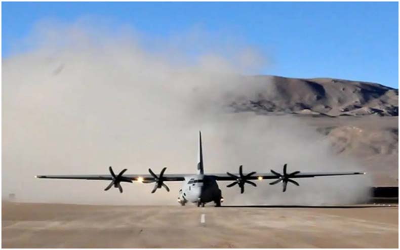
In the strategic evolution of late 2025, air power and energy security have merged into a single high-altitude contest for dominance. The centre of gravity in Ladakh has shifted to the Mudh-Nyoma Airbase, which was officially operationalized in November 2025. Situated at 13,700 feet and just 35 kms from the LAC, Nyoma has been transformed from a mud-track Advanced Landing Ground (ALG) into a world-class fighter base with a 2.7 km rigid-pavement runway. This allows the Indian Air Force to launch Rafales and Su-30MKIs directly from the roof of the world, slashing response times and neutralizing China’s airbase network in Tibet, which recently saw the completion of 36 hardened aircraft shelters at Lhunze, just 40 km from the McMahon Line. Simultaneously, a Dam War is unfolding in the Eastern Sector. Arunachal Pradesh has declared 2025–2035 as the Decade of Hydropower, reviving the mega Siang Upper Multipurpose Project to counter China’s massive upstream dam projects on the Yarlung Tsangpo. These dams are strategic water-scrapers designed to secure India’s water sovereignty while providing the energy density required to power new 4G grids and military hubs along the frontier. By building these dual-use assets, India is ensuring that its northern borders are powered by the same rivers they are designed to defend, turning the Himalayan Watershed into a self-sustaining fortress of energy and air superiority.
Hindrances & Tactical Asymmetries—The Topographical Duel.
In the strategic geography of 2025, the greatest adversary along the LAC is not always the opposing army, but the Himalayan terrain itself. A profound topographical asymmetry dictates the pace of development: while China builds on the flat, stable Tibetan Plateau, Indian engineers must contend with the young and restless mountains of the Himalayan Watershed. This region is a geological minefield of loose shale, high seismic activity, and vertical gorges that make every kilometre of road an engineering gamble.
To counter this, the Border Roads Organisation (BRO) has pivoted to Tech-First landslide management as of late 2025. Abandoning traditional cut-and-clear methods, India is now deploying sophisticated rock-bolt technology and Steel Slag road surfaces—which provide 90% greater stability in high-moisture zones. Furthermore, the use of drone-mounted LiDAR allows for the creation of high-precision 3D Digital Twins of the slopes, enabling engineers to predict and pre-empt landslips before they occur. While China uses mechanized speed to pave the plateau, India’s strategy is one of geological resilience, ensuring that the Last Mile doesn’t just reach the border, but survives the mountain’s natural fury.
Policy recommendations
- Governance. Create an inter-ministerial Border Infrastructure Council chaired by the Raksha Mantri with representation from Railways, MoRTH, Power, Finance and state governments to fast-track clearances and resolve land/forest issues.
- Financing. Blend central capital allocations, a BRO maintenance corpus, and targeted multiyear budget lines; explore sovereign-backed infrastructure bonds for long-term rail segments.
- Metrics. Track all-weather access days, time to reinforce a forward post (hours), redundancy index (number of alternate routes) and O&M funding ratio annually.
- Build redundancy, not just capacity. Fund parallel bypasses and alternate corridors to eliminate single-point failures and ensure operational continuity.
- Advance targeted rail feasibility for strategic segments. Prioritize rail links where bulk logistics yield outsized operational returns, while continuing modular airstrip and helipad expansion for tactical lift.
- Institutionalize lifecycle funding and O&M regimes. Create a dedicated maintenance corpus for BRO assets and mandate lifecycle budgeting in project approvals.
- Mandate integrated sustainment packages. Every strategic project should include resilient power (microgrids/hybrid systems), secure fiber back-haul and hardened storage to sustain C4ISR and logistics.
- Embed environmental and local-benefit safeguards. Require independent environmental monitoring, community compensation plans and local employment quotas to preserve legitimacy and reduce friction.
The Way Ahead—Securing the Himalayan Watershed.
As 2025 draws to a close, the infrastructure duel at the top of the world has evolved from a race of speed to a war of sustainability. For decades, the Himalayas acted as a passive natural wall protecting the Indian heartland. Today, that wall has been breached by technology, necessitating a shift from territorial presence to logistical dominance.
- The Digital Frontier. Beyond Bitumen,
The Last Mile is no longer just about black-topped roads; it is about the Digital Backbone. By 2030, the security of the Himalayan Watershed will depend on AI-driven sensing. With LiDAR-equipped drones and satellite-linked IoT sensors monitoring every bridge and tunnel (like the Shinku La or Sela), the Indian Army can move from Static Defence to a Dynamic Response model. Real-time data will allow for Smart Deployment, ensuring that troops are not just present, but are positioned at the exact Force Multiplier Points of the watershed. - The Green-Security Paradox. The greatest hindrance to securing the watershed is the fragile ecology. The Year of Reforms (2025) has highlighted that aggressive blasting and deforestation can lead to land subsidence (as seen in Joshimath). The way ahead requires Soft Infrastructure—sustainable engineering that respects the mountain’s geological youth. India’s success will lie in building Climate-Resilient logistics that can survive the 5-month White-Out without constant repair.
Conclusion: The Final Ascent.
Ultimately, the Himalayan Watershed is the ultimate strategic high ground. It is the ridge from which the water—and the power—of Asia flows. By Bridging the Last Mile, India is not merely building roads; it is reclaiming its historical and natural right to the crest of the continent. While China holds the advantage of the flat plateau, India’s climb up the vertical gorge is nearing its zenith. India has narrowed a long-standing infrastructure gap with China along the northern frontier and the topographical asymmetry that once hampered India is being fast replaced by a fortress of connectivity. India’s recent push in roads, tunnels, and airstrips has materially improved deterrence and operational reach. The continued funding and integrated approach will ensure achieving the target of total logistical parity by 2030. The battle for the heights is no longer about who gets there first, but who can stay there forever.
ABOUT THE AUTHOR
 Lt Gen Rajeev Chaudhry, former DG Border Roads, doubled the pace of work to meet stringent targets post Galwan clash and worked to get an incremental budget allocation of 160% for GS roads during his tenure. He infused at least 18 new technologies to enhance speed and quality of projects. He brought transparency in expenditure through increased use of GeM and ensured timely payments to the firms for which BRO was awarded Gold Certificate for two consecutive years. He also ensured desired dignity, social security and visibility to the unsung BRO Karmyogis.